Here in Virginia there is a town that proudly posts signs claiming its location as “The Center of the Universe.” Ashland doesn’t claim to be the epicenter of the Big Bang or part of the axis on which the Earth spins, though the impetus for the signs actually came during an astrophysics lecture in the 1970s. Instead, the boast is rooted in the town’s proximity to major travel arteries and its central location within the state. The map is laid out around Center Street, which indeed runs right through the middle of town. As a railroad town, the traffic on Center Street competes directly with several dozen Class I mainline trains travel daily on rails embedded the length of the asphalt. Pretty much everything revolves around that one stretch of road.
Ashland isn’t the only city that has claimed to be the center of one universe or another. Dozens of cities and for some reason, train stations, have adopted the slogan. Signs claiming as much dot the landscape, appearing in places like Seattle, Washington and Philo, Illinois.
The city of New York has several locations that have been dubbed Center of the Universe. The first half of the 20th Century saw NYC in an uninterrupted reign as the Center of the Baseball Universe, a position so secure that no sign was needed. At the midpoint of the century 3 of the 14 MLB ballparks in use were in the city. A New York team played in more than 70% of the World Series played between 1920 to 1957 and more than a third of the championship series played in that span featured two New York clubs.
MAPPING THE CENTER OF THE UNIVERSE
Residents of the five boroughs could pass the time arguing why their particular team was at the crux of baseball’s gravitational well, holding the other teams in orbit. While such battles can be waged with hand gestures and shouting the names of Mays, Mantle, and Snider, they can be looked at more persuasively with numbers. No, not baseball statistics, as that would make too much sense. What I want to know is where is the geographic center of New York baseball.
This search begins with the coordinates of the sites formerly housing the city’s three major stadiums.
| Stadium | Latitude | Longitude |
|---|---|---|
| Ebbets Field | 40° 39’54” N | 73° 57’29” W |
| Polo Grounds | 40° 49’54” N | 73° 56’14” W |
| Yankee Stadium | 40° 49’37” N | 73° 55’41” W |
The simple way to find the geographical midpoint of these locations would be to average the coordinates. This method works fine for general approximations within a single city, but quickly breaks down as inputs move further apart. The reason for this is the fact that longitudinal lines (meridians) are spaced far apart at the equator and intersect at the poles. The distances between meridians change with each passing mile with the effect becoming more pronounced as one gets further North or South. This span between a single meridian is over 69 miles at the equator, 60 miles at the 30th parallel in Houston, and not quite 18 miles at the 75th in Northern Finland.
To get a better average, one can make use of the assumption that the Earth is a sphere. A line can be drawn from any point on the globe to its center. The length of this line is equal to the radius of the sphere. A second line of equal distance can be drawn from the center to another point anywhere else on the globe. If a third line is drawn across the surface of the sphere between the two points you get a triangle with the dimensions of two sides already known. This implies it is possible to calculate the value of the third line, which just so happens to be the distance between the locations being analyzed. Using a bit of trigonometry you can adjust for the curvature of this third line and find the midpoint. It’s complicated, but luckily the math can be tackled at scale in any spreadsheet program. Click here if you’re interested in how to go about doing this in Excel.
So where do these calculations lead us? It turns out any 1950s New Yorker arguing in favor of the spot of land they are standing would be wrong. The geographical midpoint of the three classic stadiums turns out to be in the East River just off 87th Street and Carl Schurz Park.
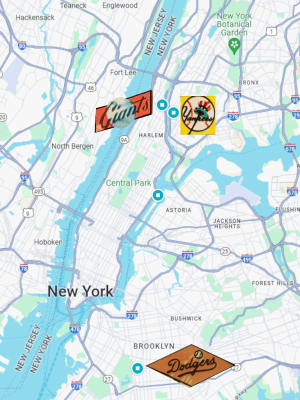
Anyone wanting to visit the site needs to hop on the NYC Ferry at the 90th Street Terminal and look west towards the park from the channel.
Given its status as the only city with three MLB teams and the near constant procession of postseason appearances, New York was undoubtedly the cultural center of early and mid-20th century baseball. What about the geographic center of all of MLB? What team could conceivably use maps to back up claims of being at the center of the game?
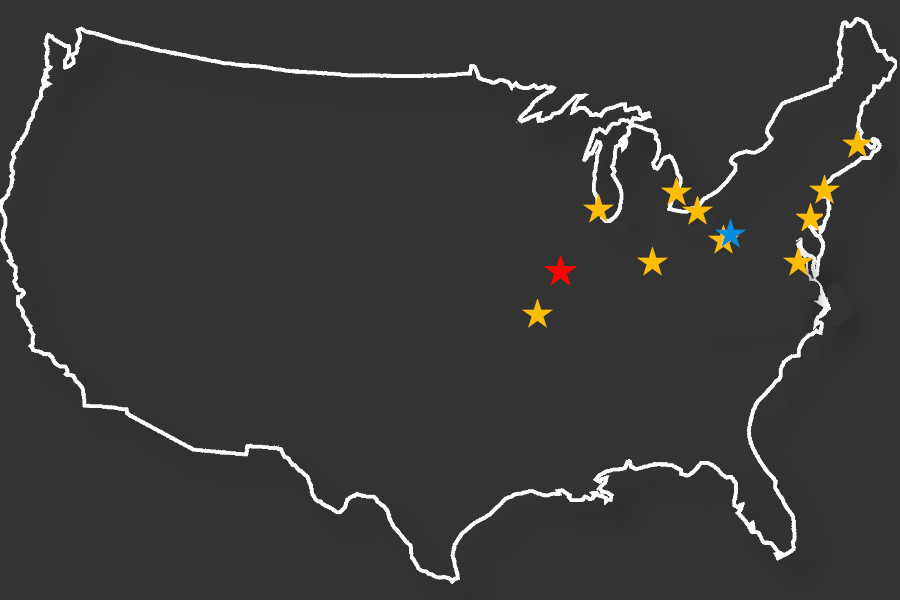
Here are the teams and stadiums comprising the American and National Leagues at the outset of the 1950s:
| Team | Stadium | Latitude | Longitude |
|---|---|---|---|
| Boston Braves | Braves Field | 42° 21’12” N | 71° 07’09” W |
| Boston Red Sox | Fenway Park | 42° 20’46.5″ N | 71° 05’51.9″ W |
| Brooklyn Dodgers | Ebbets Field | 40° 39’54” N | 73° 57’29” W |
| Chicago Cubs | Wrigley Field | 41° 56’53” N | 87° 39’20” W |
| Chicago White Sox | Comiskey Park | 41°49’54″N | 87°38’03″W |
| Cincinnati Reds | Crosley Field | 39° 07’0″ N | 84° 32’07” W |
| Cleveland Indians | Municipal Stadium | 41° 30’12.6″ N | 81° 41’35.4″ W |
| Detroit Tigers | Briggs Stadium | 42° 19’55” N | 83° 04’08” W |
| New York Giants | Polo Grounds | 40° 49’54” N | 73° 56’14” W |
| New York Yankees | Yankee Stadium | 40° 49’37” N | 73° 55’41” W |
| Philadelphia Athletics | Shibe Park | 39° 59’46” N | 75° 09’54” W |
| Philadelphia Phillies | Shibe Park | 39° 59’46” N | 75° 09’54” W |
| Pittsburgh Pirates | Forbes Field | 40° 26’18.6″ N | 79° 57’09” W |
| St. Louis Browns | Sportsman’s Park | 38° 39’28.8″ N | 90° 13’12” W |
| St. Louis Cardinals | Sportsman’s Park | 38° 39’28.8″ N | 90° 13’12” W |
| Washington Senators | Griffith Stadium | 38° 55’03” N | 77° 01’13” W |
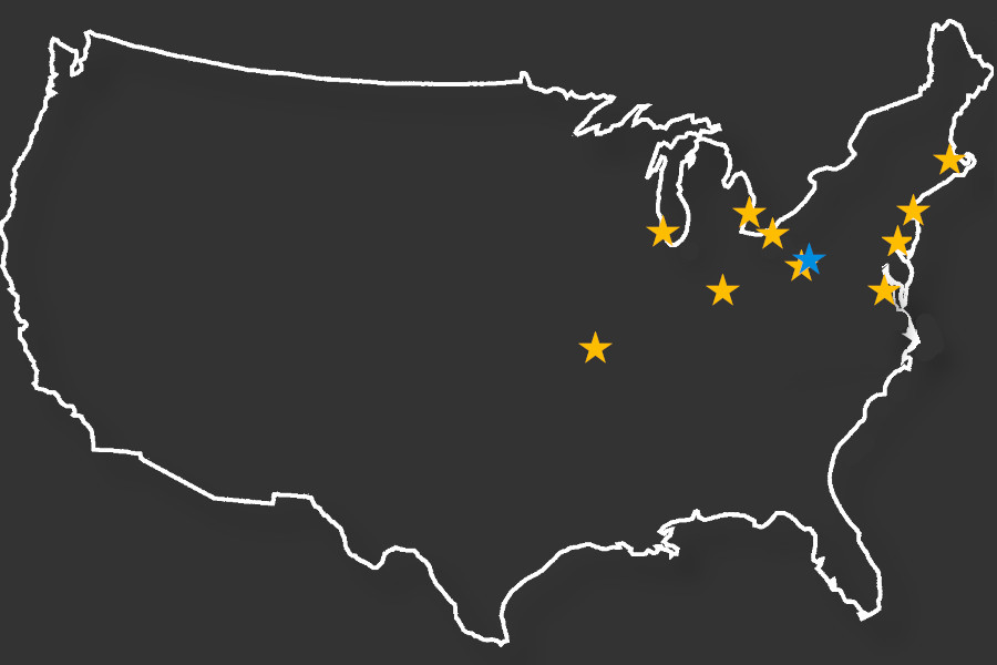
Using the same methodology that dunked us in the East River, we find the midpoint of these stadiums lies at 40o 50’08.2″N by 79o 48’31.5″W. This puts us right in the middle of a long residential driveway in Herman, PA and just 28.5 miles from home plate at Forbes Field. The Pittsburgh Pirates, the National League representatives in the very first World Series, seem to have a solid claim for being at the epicenter of early 20th-century baseball.
GEOGRAPHIC DISCONNECT
As the previous image highlights, MLB baseball was something of a regional activity relegated to the Northeast as recently as the early 1950s. This makes sense, as the region has historically formed the core of the nation’s population. The first US Census reported a mean center of the population just east of Baltimore in 1790 and our capital was built not far away. That average location slowly drifted west as time progressed, drifting into eastern Illinois by 1950 and settling outside of Hartville, MO in the latest iteration. Transportation networks allowed easy movement between these cities while the West would not open up to transcontinental sports until air travel became widespread.
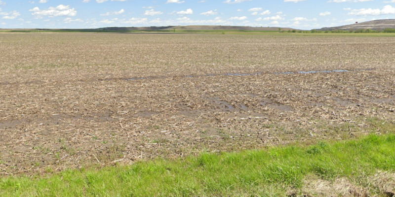
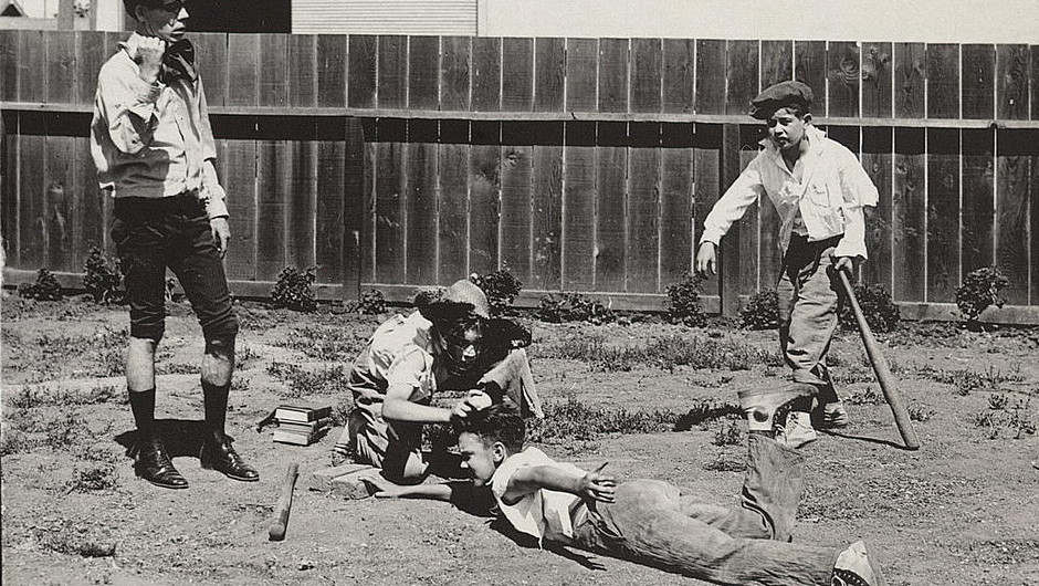
Here is where another question pops up. With most ballparks located in the northeast, where did teams look to find the ballplayers that patrolled their diamonds? To answer this question, I turned to my collection of 1952 baseball cards. Topps’ 407-card checklist from that year featured more cards than anything seen since the famed T-206 tobacco cards. Considering that the 500+ cards the T-206 checklist might actually be an amalgamation of several visually similar but different issues, Topps may very well have created the largest set of baseball cards up to that point in history. That has the making of a very good sampling of the players who saw action in that era. Making things even better, Topps saw fit to include a burst of demographic information on the back of each card that included player hometowns.
I input each of the 407 locations and corresponding latitude/longitude coordinates into a workbook (This is Card Boredom after all). While doing so, I hypothesized that the geographic midpoint for these athletes would be somewhat near that of the general population. Cognizant of the story of limited scouting resources deployed to watch cooler climate players like Mike Trout in recent years, I thought there might be a slight tilt to the South relative to the general population. The rise of the thriving Pacific Coast League helped likewise bolster the gravitational pull from this direction. I didn’t hazard any guesses as to what affect the international players from six different countries would have, though the sheer force of numbers meant any effect was likely to be muted.
Applying the same methodology that identified Pennsylvania as the center of American and National League ballparks, I found the midpoint of the ’52 Topps checklist to be located in a corn field off of Ball Road in Waggoner, Illinois. This turns out to be a little over 100 miles to the northwest from the 1950 Census average and just under 600 miles from the average ballpark.